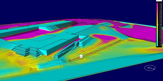
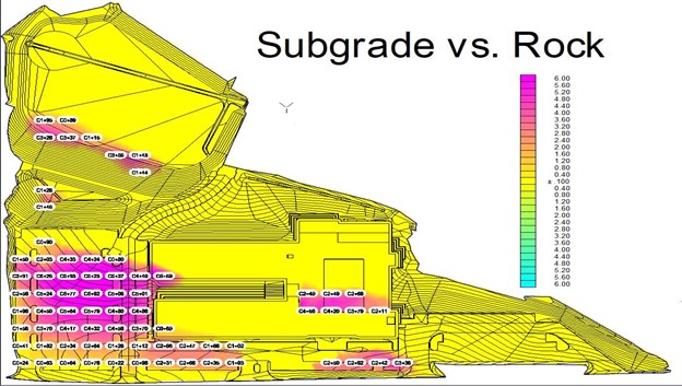
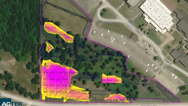
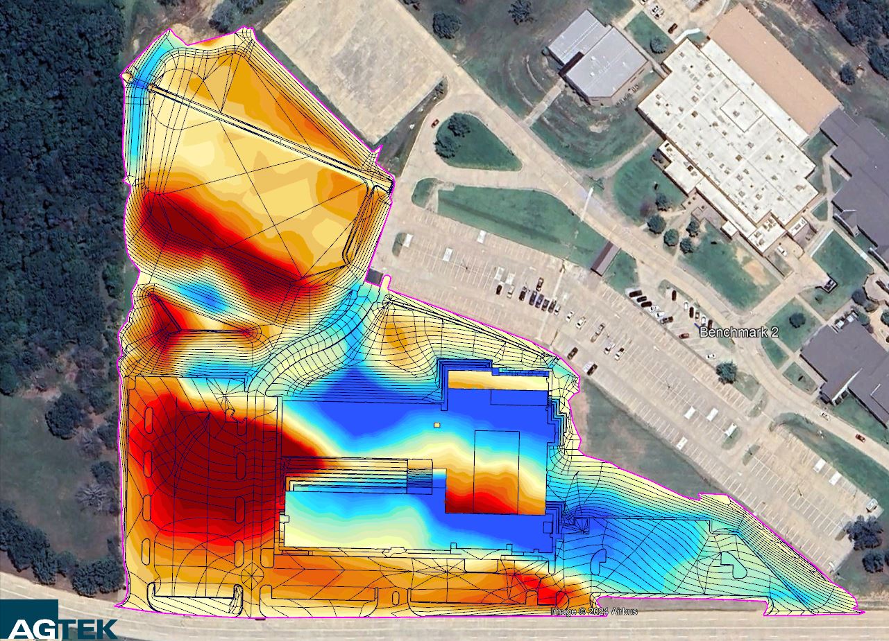
Middle School Client ThemeHt Date 10/20 Category GPS Model Location 5th Street, New York, USA Project Overview In October 2020, Section31 undertook a complex site development project encompassing multiple facets of GPS data modeling. Site Area and Infrastructure Breakdown Building Pad: 90,400sqft – Multi level slab with subterranean storm shelter; 5’ Horizontal overbuild with 3’ over excavation & 3’ select fill.Paving: 138,600sqft – Concrete & HMACPonds: 3.7ac Project Timeline and Deliverables October 29th: Client submits takeoff request with PDF documents, CAD & takeoff order form.November 1st: Takeoff delivered with volume report(PDF & Excel), color cut/fill map & KMZ overlay.November 29th: Project awarded to client with issued for construction plans, CAD & control points provided. Project start date scheduled for March.December 3rd: GPS model in progress as shown below. December 4th: Rock excavation map and quantities requested by client.December 5th: Rock surface map provided to client with quantities = 12,549 cubic yards of rock excavation to achieve subgrade. December 7th: GPS Model completed and delivered to client April 2021: Construction complete and ready for students.